
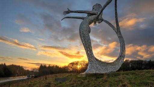
กิจกรรมในแอร์ดรี
กิจกรรม ที่ท่องเที่ยว และทัวร์
เที่ยว แอร์ดรี


กิจกรรม

ทัวร์รถบัส Hop-On Hop-Off ชมวิวเมืองกลาสโกว์
฿1,204
ต่อผู้ใหญ่ 1 คน
90% ของนักเดินทางแนะนำกิจกรรมนี้

ทัวร์ชมพิพิธภัณฑ์ฟุตบอลสกอตแลนด์และสนามแฮมป์เดนพาร์ค
฿669
ต่อผู้ใหญ่ 1 คน
100% ของนักเดินทางแนะนำกิจกรรมนี้


กลาสโกว์: ทัวร์โรงกลั่น Glengoyne พร้อมวิสกี้และช็อคโกแลต
฿1,783
ต่อผู้ใหญ่ 1 คน
100% ของนักเดินทางแนะนำกิจกรรมนี้

กลาสโกว์: ทัวร์พร้อมไกด์และเบียร์ฟรีหนึ่งแก้วที่โรงเบียร์เทนเนนต์
฿936
ต่อผู้ใหญ่ 1 คน

กลาสโกว์: ทัวร์เดินชมถนนพร้อมไกด์
฿669
ต่อผู้ใหญ่ 1 คน
96% ของนักเดินทางแนะนำกิจกรรมนี้

จากกลาสโกว์: ทัวร์เต็มวัน โอบัน, ล็อคโลมอนด์, เกลนโค และอินเวอเรย์
฿2,853
ต่อผู้ใหญ่ 1 คน

จากกลาสโกว์: ทัวร์กลุ่มเล็กที่ไฮแลนด์สของสกอตแลนด์และทะเลสาบล็อกเนสส์หนึ่งวัน
฿3,478
ต่อผู้ใหญ่ 1 คน
100% ของนักเดินทางแนะนำกิจกรรมนี้

กลาสโกว์: Glencoe, เดินเล่นชมวิว และทัวร์ที่ราบสูงของสกอตแลนด์
฿4,681
ต่อผู้ใหญ่ 1 คน
100% ของนักเดินทางแนะนำกิจกรรมนี้
 ดูกิจกรรมสำรวจประสบการณ์นับพัน ตั้งแต่กิจกรรม สถานที่ท่องเที่ยว ไปจนถึงทัวร์รายวันและบริการรับส่ง
 จองได้อย่างง่ายดายไม่ต้องต่อคิว จองตั๋วออนไลน์ภายในไม่กี่นาทีเพื่อเข้าชมสถานที่ท่องเที่ยวยอดนิยมพร้อมยกเลิกหลายกิจกรรมได้ฟรี
 ให้รางวัลตัวเองสมาชิกประหยัดอย่างน้อย % เมื่อคุณจองกิจกรรม
สถานที่น่าเที่ยว {location.name}
1. OVO Hydro
อาคารขนาด 12,000 ที่นั่งถูกจับจองพื้นที่อย่างรวดเร็ว เมื่อแฟนๆ ของนักแสดงมากความสามารถต่างมารวมตัวกันเพื่อรอชมการแสดง สัมผัสบรรยากาศอันน่าตื่นตาตื่นใจไปพร้อมกับผู้คนมากมาย และร้องคลอไปกับบทเพลงจากวงดนตรีที่คุณโปรดปราน
ดูเพิ่มเติม
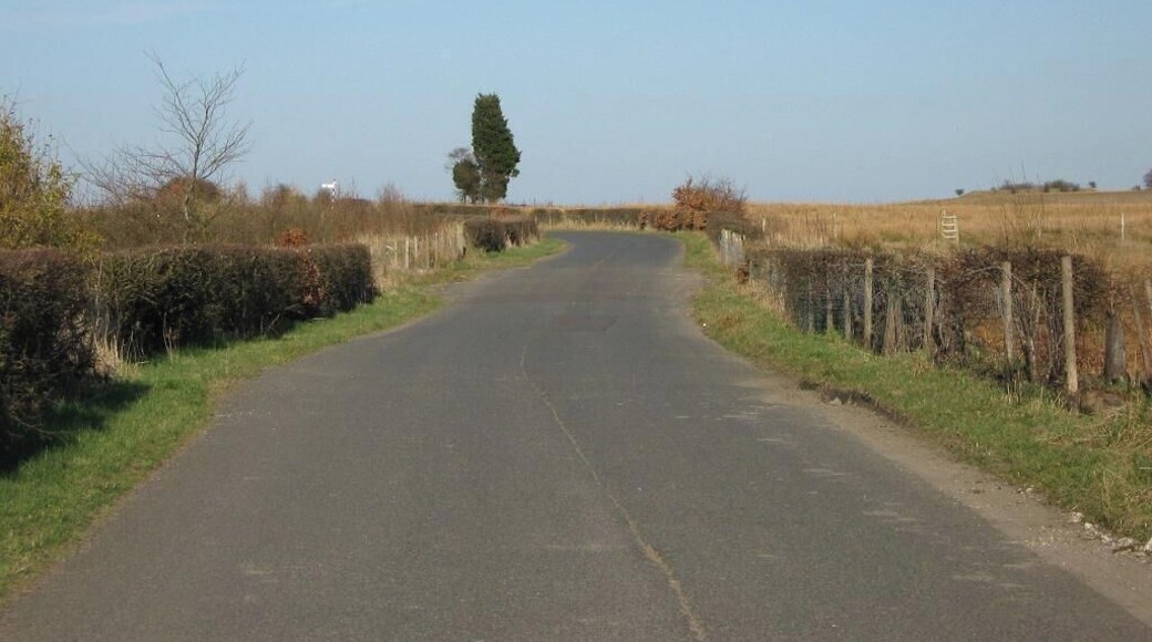
2. อุทยานแห่งชาติ Loch Lomond and The Trossachs
ทะเลสาบโลมอนด์และอุทยานแห่งชาติทรอสแซคส์ มีทิวทัศน์น่าตื่นตาตื่นใจที่สุดแห่งหนึ่งในประเทศ อยู่ห่��างจากกลาสโกว์ทางเหนือเพียง 1 ชั่วโมงทางรถยนต์ หมู่บ้านต่างๆ ในบริเวณนี้มีประวัติศาสตร์และตำนานอันยาวนาน และร้านอาหารท้องถิ่นหลายแห่งมีการนำเสนออาหารที่จัดหาในท้องถิ่นอย่างน่าภาคภูมิใจ
ดูเพิ่มเติม

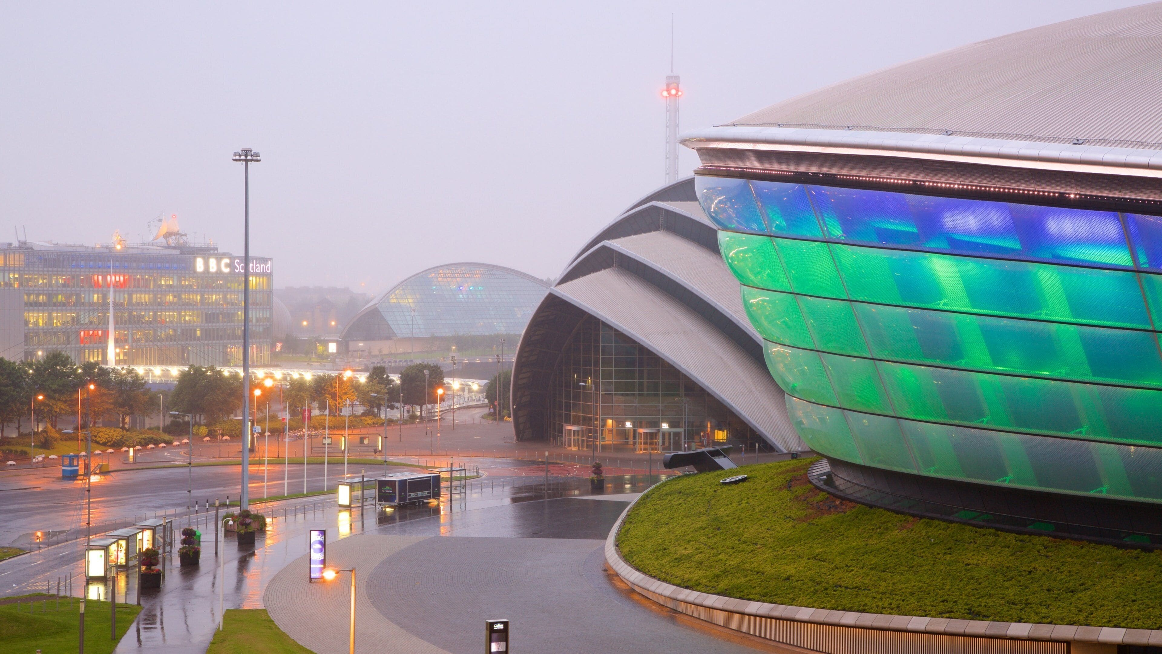
3. ศูนย์การประชุมและแสดงสินค้าสก็อต
ศูนย์การประชุมและนิทรรศการแห่งสกอตแลนด์ (SECC) มีชื่อเสียงโด่งดังสำหรับการจัดงานที่มีขนาดใหญ่ที่สุดหลายงานในสหราชอาณาจักร อาคารต่างๆ ประกอบศูนย์การประชุมที่มีการก่อสร้างสะดุดตาริมฝั่งแม่น้ำ โดยมีสถาปัตยกรรมด้วยโลหะแบบร่วมสมัยที่เข้ากับย่านริมน้ำสมัยใหม่ และยังมีพิพิธภัณฑ์ที่มีสไตล์สองแห่งอีกด้วย เดินตามริมฝั่งแม่น้ำไคลด์เพื่อชื่นชมโครงสร้างที่ไม่เหมือนใคร หรือเข้าร่วมการจัดงานที่จัดขึ้นในอาคาร
ดูเพิ่มเติม

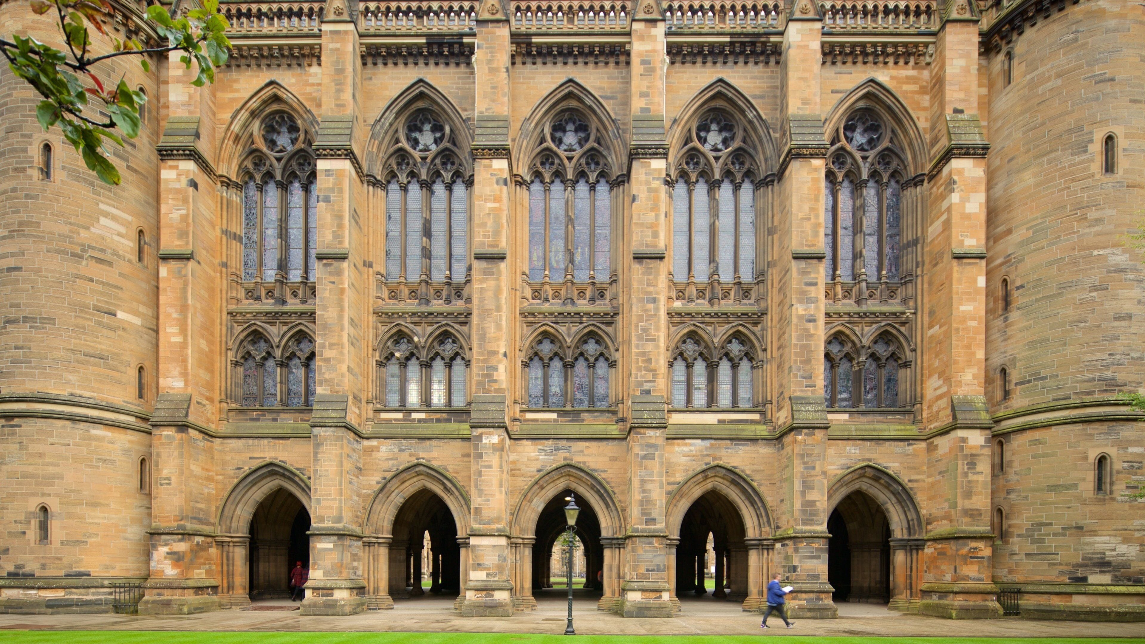
4. มหาวิทยาลัย Glasgow
เดินปะปนกับนักวิชาการและนักศึกษาขณะที่เดินท่องเที่ยวไปตามอาคารแห่งการเรียนรู้ในมหาวิทยาลัยกลาสโกว์ คุณไม่จำเป็นต้องสมัครเข้าเรียนก็สามารถเพลิดเพลินกับทิวทัศน์ทางประวัติศาสตร์ของวิทยาลัยที่เก่าแก่เป็นอันดับสองของสกอตแลนด์แห่งนี้ และสามารถเข้าร่วมฟังการบรรยายสำหรับสาธารณะ และคอนเสิร์ตที่จัดขึ้นโดยมหาวิทยาลัย เดินทางไปที่วิทยาเขตกิลมอร์ฮิลล์ทางตะวันตกสุดของเมืองเพื่อชมสถานที่น่าสนใจหลักๆ
ดูเพิ่มเติม
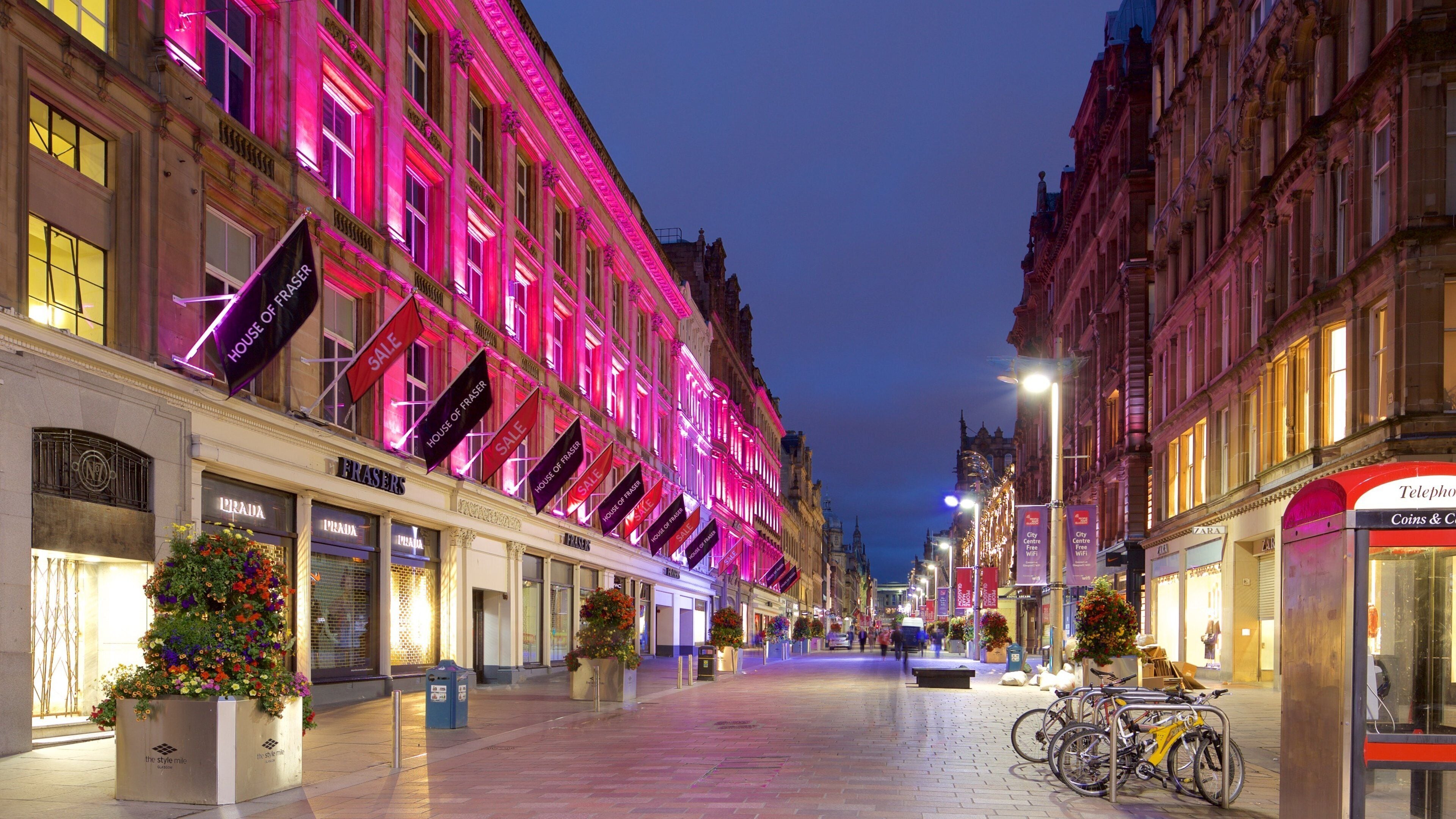
5. ถนน Buchanan
ถนน Buchanan Street นับว่าเป็นสถานที่ท่องเที่ยวยอดนิยมสำหรับการมาทัวร์เมืองกลาสโกว์ เนื่องจากถนนเส้นนี้คั่นอยู่ระหว่างสถานีการเดินทางหลักถึงสองจุด ใช้เวลาของคุณบนถนนอันกว้างขวางปราศจากการจราจร ระหว่างเดินเล่นไปตามเขตเมืองที่อุดมไปด้วยหลายเชื้อชาติ เที่ยวเตร่ไปตามย่าน "Style Mile" พร้อมเพลิดเพลินกับการช็อปปิ้งและชมทัศนียภาพตลอดช่วงบ่าย
ดูเพิ่มเติม
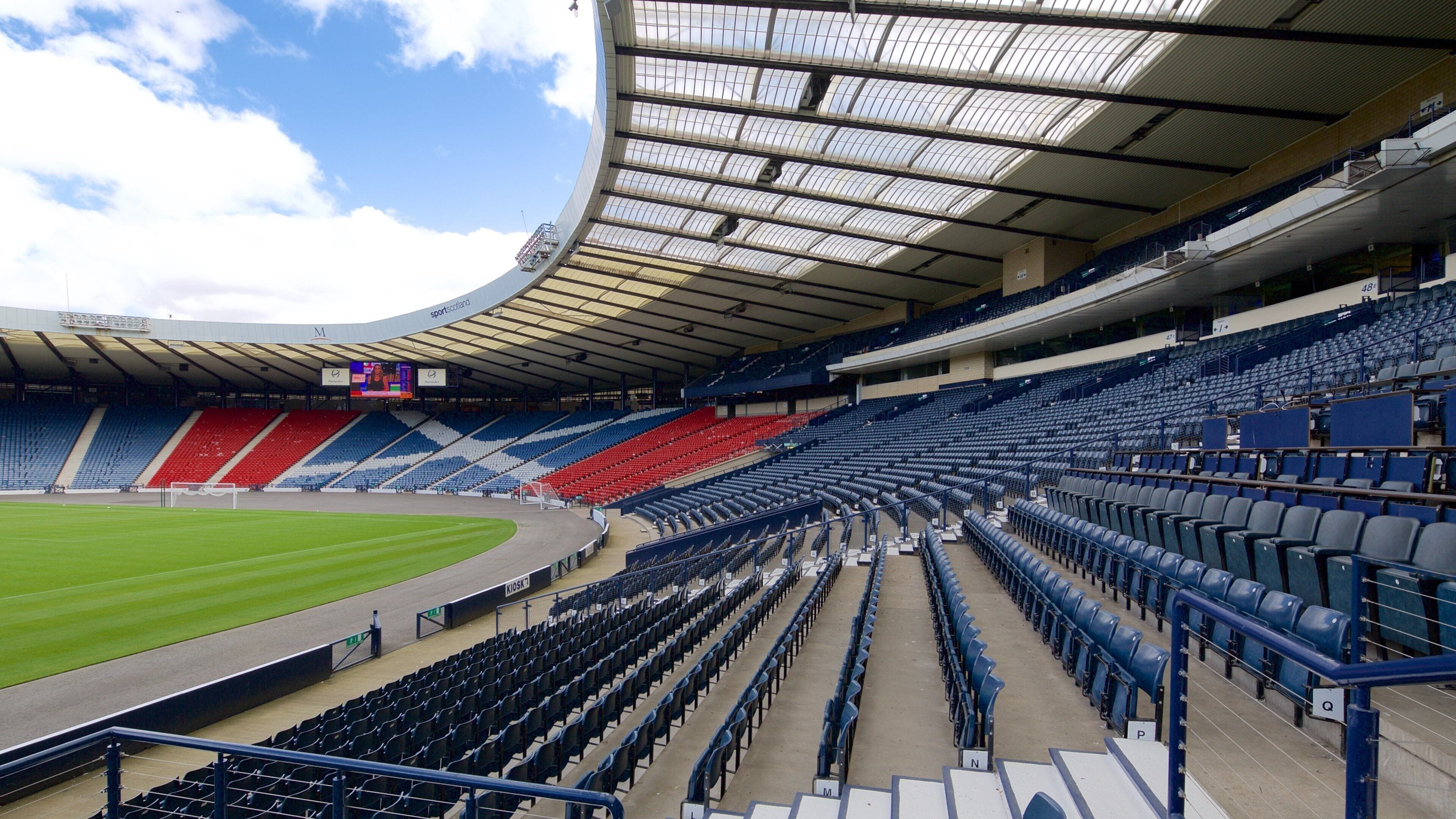
6. สวน Hampden
สัมผัสกับประสบการณ์อันน่าตื่นเต้นเร้าใจไปกับการชมการแข่ง��ขันกีฬาแบบสดๆ ในสนามแฮมป์เดนพาร์ก หนึ่งในสนามแข่งขันที่มีชื่อเสียงมากที่สุดในแวดวงลูกหนัง สนามแห่งนี้เป็นสนามเหย้าของทีมฟุตบอลทีมชาติสก็อตแลนด์ รวมถึงเป็นบ้านของ สโมสรฟุตบอลควีนสพาร์ก อีกด้วย ร่วมเป็นหนึ่งไปกับกองเชียร์ในการชมศึกดวลแข้งภายในสนาม หรือเยี่ยมชมพิพิธภัณฑ์ของสนามที่บอกเล่าเรื่องราวความเป็นมาของกีฬาฟุตบอลในสก็อตแลนด์จากอดีตถึงปัจจุบัน
ดูเพิ่มเติม
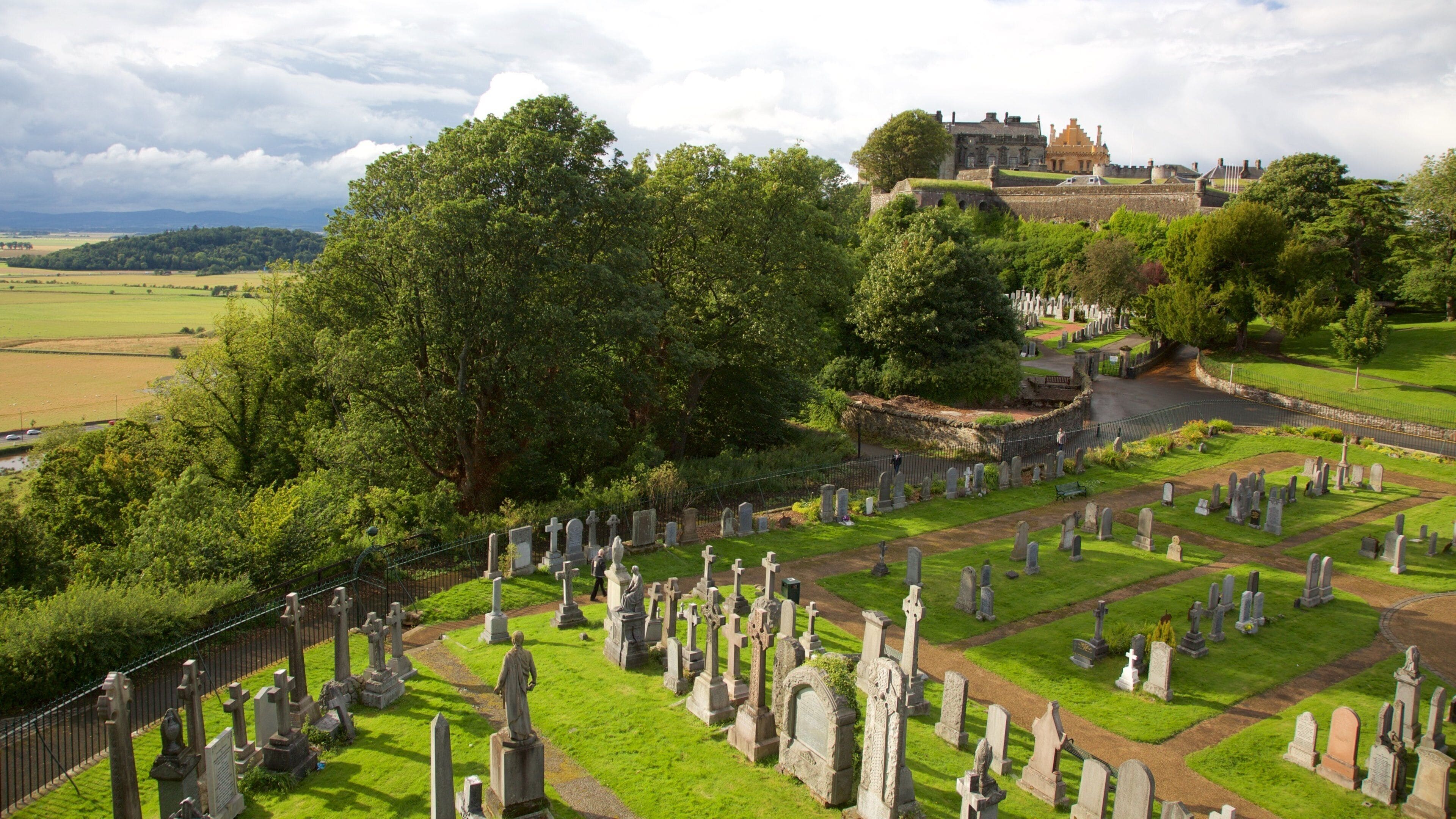
7. ปราสาท Stirling
ปราสาทสเตอร์ลิงเป็นที่ประทับของกษัตริย์และผู้ปกครองของสก็อตแลนด์เป็นเวลาหลายร้อยปี โดยตั้งตระหง่านอยู่เหนือเมืองบนยอดภูเขาไฟที่ดับแล้ว สถานที่สำคัญแห่งนี้มองเห็นได้ไม่ว่าจะชมทัศนียภาพของบริเวณดังกล่าวจากจุดไหน และภายในปราสาทก็สวยสง่าไม่แพ้กัน โดยมีห้องที่มีสีสันสดใส และได้รับการดูแลรักษาเป็นอย่างดี ทำให้นักท่องเที่ยวได้เห็นวิถีชีวิตราชวงศ์ของสก็อตแลนด์ในอดีต เรียนรู้เกี่ยวกับการประสูติ การอภิเษกสมรส และการสิ้นพระชนม์ในนิทรรศการอินเทอร์แอคทีฟและของที่จัดแสดงไว้พร้อมรายละเอียด
ดูเพิ่มเติม


