
ไฮเออร์ คินเนอร์ตัน
คู่มือท่องเที่ยว


เที่ยว ไฮเออร์ คินเนอร์ตัน

Titanic Hotel Liverpool
"decided to have dinner at the stanley bar and grill, starters were lovely, the mains came out and they had forgot mine which they gave us a free drink to compensTe and they made my meal, it arrived and after two bites of my burger it seemed very dry and had a very bad chemical aftertaste, we complained ..."
รีวิวเมื่อ 20 มิ.ย. 2026

The Mill Hotel & Spa
"Excellent breakfast included in the price. Room was very hot and had difficulty with our door locking but this was sorted out immediately"
รีวิวเมื่อ 21 มิ.ย. 2026

โรงแรมมัลดรอน ลิเวอร์พูล ซิตี้
"The location for both the waterfront and for Liverpool One was excellent. The staff were very professional yet friendly, the room lived up to expectations and the breakfast was varied and well presented."
รีวิวเมื่อ 21 มิ.ย. 2026

ซิทาดีนส์ ซิตี้ เซ็นเตอร์ ลิเวอร์พูล
"ใกล้แหล่ง shopping คนเยอะ แต่ห้องไม่มีเสียงเข้ามา สงบดี ห้องกว้าง สะอาด"
รีวิวเมื่อ 5 เม.ย. 2024

8 สแตนลีย์ สตรีท

Aparthotel Adagio Liverpool City Centre
"Excellent value will book agsin"
รีวิวเมื่อ 21 มิ.ย. 2026
สถานที่ยอดนิยม

สวนสัตว์เชสเตอร์
เดินข้ามสะพาน หมู่เกาะ และพื้นที่ห่างไกลที่จำลองเหมือนจริงภายในสวนแห่งนี้ ชมสัตว์ป่าหายากและแปลกตามากกว่า 400 สายพันธุ์

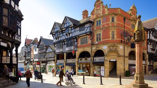
กำแพงเมืองเชสเตอร์
ตามรอยทหารยุคโรมัน นัก��รบชาวนอร์มัน และพลเมืองจอร์เจียนที่เดินทางข้ามกำแพงเหล่านี้เมื่อหลายศตวรรษก่อน

สนามแข่งม้าเชสเตอร์
สนามแข่งม้าเชสเตอร์, เชสเตอร์ เป็นที่เที่ยวที่ใครก็ต้องประทับใจ เดินเล่นเลียบแม่น้ำรับบรรยากาศดีๆ หรือประทับใจกับการไปเยือนสปาได้ในย่านนี้

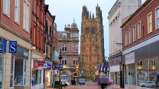
วิหารเชสเตอร์
เดินขึ้นสู่ยอดหอระฆังอันเป็นสถานที่สำคัญเพื่อชมทิวทัศน์ของเมือง หรือชมนกล่าเหยื่อในลานเหยี่ยวที่โบสถ์ที่มีความสำคัญทางประวัติศาสตร์แห่งนี้
สวน Grosvenor
ชมละครเชกสเปียร์ในโรงละครกลางแจ้ง สำรวจประตูโค้งยุคกลาง และนั่งรถไฟขนาดเล็กในสวนยุควิกตอเรียแห่งนี้

มหาวิทยาลัยเชสเตอร์
ท่องเที่ยวสถาบันการศึกษาระดับสูงที่เก่าแก่ที่สุดแห่งหนึ่งของอังกฤษเพื่อชมการผสมผสานที่น่าหลงใหลของสถาปัตยกรรมยุควิคตอเรียและรูปลักษณ์อันทันสมัยเข้าไว้ด้วยกัน
กิจกรรม


ลิเวอร์พูล: ทัวร์ชมเมืองและสถานที่ถ่ายทําภาพยนตร์เดอะบีทเทิลส์ พร้อมขึ้นลงรถได้ฟรี 48 ชั่วโมง
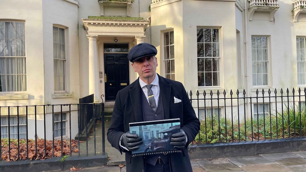
ลิเวอร์พูล: ทัวร์เดินชมศูนย์กลางเมืองพีกี้ ไบลน์เดอร์สอย่างเป็นทางการ

บรันช์แก้แฮงค์ | บิงโกและแดร็กควีน เบนิดอร์ม

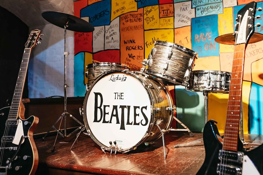
ลิเวอร์พูล: เรื่องราวของเดอะบีทเทิลส์ (บัตรเข้าชม)
สำรวจโลกแห่งการเดินทางไปกั��บเอ็กซ์พีเดีย
- สวนสัตว์เชสเตอร์
- ท่าเรือรอยัล อัลเบิร์ท
- กําแพงเมืองเชสเตอร์
- สนามแข่งม้าเชสเตอร์
- สนามกีฬาธนาคารมาร์ค แอนด์ สเปนเซอร์
- ห้างลิเวอร์พูล วัน
- พิพิธภัณฑ์ Beatles Story
- ท่าเรือเฟอร์รี่ลิเวอร์พูล เพียร์ เฮด
- Cheshire Oaks ดีไซเนอร์เอาท์เล็ท
- สวน Sefton
- วิหารเชสเตอร์
- แคเวิร์นคลับ
- สะพานส่งน้ําพอนต์คีซิลเต
- สนามแข่งม้า Racecourse Ground
- สวน Grosvenor
- St. George's Hall
- สะพาน Llangollen
- Royal Liver Building
- วัดลิเวอร์พูล
- ปราสาท Ruthin

